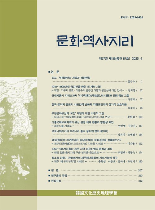
- 영문명
- Changing Landscape of the Kimpo-Bupyong Plains
- 발행기관
- 한국문화역사지리학회
- 저자명
- 홍금수(Keumsoo Hong)
- 간행물 정보
- 『문화역사지리』제37권 제1호, 1~36쪽, 전체 36쪽
- 주제분류
- 사회과학 > 지리학
- 파일형태
- 발행일자
- 2025.04.30
7,120원
구매일시로부터 72시간 이내에 다운로드 가능합니다.
이 학술논문 정보는 (주)교보문고와 각 발행기관 사이에 저작물 이용 계약이 체결된 것으로, 교보문고를 통해 제공되고 있습니다.

국문 초록
중부지방의 곡창이었던 김포들은 안양천·굴포천·걸포천·봉성포천 등 한강 지류를 따라 발달한 평야의 총 칭이지만, 굴포천 유역의 지역민은 1914년 부천으로 대체되기 전의 부평을 기억해 부평들의 토착명을 고수해 왔 다. 김포·부평평야는 해수면 상승과 한강의 범람을 거시적, 직접적 성인으로 하며 지천으로 흘러든 한강과 밀물이 운반한 하해혼성 물질로 구성된다. 내륙의 광활한 저습지와 만연한 침수 및 한발의 자연재해로 토지이용은 조방 적이었다. 제약에도 삼국시대 장제의 축조, 12~13세기 배수 개선, 조선시대 제언 확충과 궁방전·아문둔전·민전 개 발이 있었다. 개화기에 수륜원을 중심으로 황무지 개간을 적극 추진하지만 일제는 국유미간지이용법을 제정, 다 용도 초평을 강탈하여 식민자본가와 회사에 특혜 부여·불하한다. 수방·관개·배수를 목적으로 설치된 양동·양천· 부평 수리조합은 총독부 보조를 받은 신곡·김포·양동식산 등의 농장과 함께 일대의 경관변화를 주도하며, 특히 신 곡양수장을 주수원으로 둔 부평수조(한강수조)는 구역 확장과 군소 조합의 합병을 거쳐 김포·부평들 대부분을 관 개구역에 두게 된다. 1930년대 전시정국에 조성된 경인선 부평역 일대 군산복합단지와 소사역전 취락은 서울~인 천 연담화를 매개하였고 현재 접경지역을 향해 북상하고 있는 도시화와 산업화의 전선은 농업경관을 도시·산업 경관으로 대체하고 있다.
영문 초록
The Kimpo Plains represents a series of floodplains on the rivers of Anyang, Koolpo, Keolpo, Bongsungpo, etc. Yet the Koolpo river valley has been called exceptionally by the vernacular name of Bupyong Plains. Although the Kimpo-Bupyong Plains laid for a long time underutilized due to the presence of internal swamps and recurrent flooding and droughts, consistent efforts had been made to enhance the intensity of the land use, including the construction of Grand Reservoir and the draining projects prior to the 14 century and th other hydraulic engineering undertakings thereafter. Despite the speedy progression of internal improvement driven by the chartered estates of royal family and local governments in Joseon Korea and the institutionalization of reclamation by Emperor Kojong, it was Japanese colonial capitalists assisted by ‘Utilization Act of Unreclaimed National Land’ that monopolized the profits. Multi-use pasture became the main target of improvement to be usurped by Japanese landlords and colonial companies. The establishment of modern irrigation associations for flood-prevention, irrigation and drainage played essential roles in water control and landscape transformation. The town at Sosa Station and the Military-Industry complex in the neighborhood of Bupyong Station mediated the shaping of Seoul-Incheon conurbation. The ongoing industrialization and urbanization have replaced the agrarian land with post-industrial landscape.
목차
1. 서론
2. 평야의 형성과 초기 개발
3. 국유지 창출과 미간지 개발
4. 수리조합 주도 김포·부평들의 개발
5. 경인연담도시화와 토지이용의 전환
6. 결론
참고문헌
키워드
해당간행물 수록 논문
- 김포·부평평야의 개발과 경관변화
- 한국 유적지 분포의 시공간적 변화와 지형요인과의 장기적 상호작용
- 1950~90년대 충남 공주 지역 섬유산업의 등장과 쇠퇴 - 해당 업종 종사자의 구술 분석을 중심으로
- 근대계몽기 지리교과서 『디구약론(地璆略論)』의 내용과 간행 정보 고찰
- 1910~1920년대 금강산을 향한 세 개의 시선 - 게일·기쿠치 유호·이광수의 금강산 여행과 금강산에 대한 인식
- 코로나19시기의 우리나라 종교 용지의 변화 분석(II)
- 문화역사지리 제37권 제1호 목차
- Reconceptualizing Safeguarding Intangible Cultural Heritage : The case of Jeju Haenyeo Culture, a UNESCO Intangible Cultural Heritage
- 다중국제보호지역의 유산 설명 체계 현황과 방향성 제언 - 제주도를 사례로
- 유질(類質)의 자연환경은 동상(同像)의 문화경관을 창출하는가? - 제주도(濟州島)와 크라스(Kras) 지방을 사례로
- 장소성 만들기 관점에서의 제주해녀문화의 지속가능성 탐구 - 제주 ‘해녀의 부엌’을 사례로
참고문헌
교보eBook 첫 방문을 환영 합니다!

신규가입 혜택 지급이 완료 되었습니다.
바로 사용 가능한 교보e캐시 1,000원 (유효기간 7일)
지금 바로 교보eBook의 다양한 콘텐츠를 이용해 보세요!


